
Holly places
Site 1 The Plain of El-Raha and Aaron’s Hill
Site 2 The Golden Calf
Site 3‘The Askar’: Barracks of Abbas Pasha
Site 4 Roman Quarry
Site 5 Monastery of Saint Katherine (Catherine)
Site 6 Camel Path
Site 7 Jebel El-Deir Path
Site 8 Saddle Between Wadi El-Deir and Wadi Isbaiyah
Site 9 Galaktion and Episteme
Site 10 Camel Station and Cutting
Nature Notes
Prepearations
You are one of thousands who have set out to climb Mount Sinai, or Jebel Musa. Pilgrims, travelers and visitors have been attracted to the religious landscape of Mount Sinai for centuries. As you ascend the path the guide will help you identify the chapels, mosques and the other sacred sites you will see and also describe the dramatic events such as the Burning Bush and the receiving of the Ten Commandments that happened in this part of the Sinai desert between 3500 and 3200 years ago. For some the ascent is merely a physical experience but those who choose to understand the history of the "God-Trodden Mount", and respect its 1600 year old monastic tradition will undoubtedly discover something more spiritual.
From the path you will see churches, chapels, mosques and sacred sites nestled in basins and standing peaceably on summits. These places represent a common link in the faith of Christians, Jews and Muslims. Biblical and Quranic accounts describe the exalted events that occurred "in the Sinai desert" (Exodus 19:1) between 1500 and 1200 BC.
The local Jebeliya Bedouin also have a particular regard for Mount Sinai as a holy mountain and over the centuries the Jebeliya have developed a unique relationship with the Monastery.
The monastic tradition grew from the 3rd century when many early Christians sought refuge from the persecution of pagan Rome in the holy mountains of south Sinai. Relics of these Roman and Byzantine times can still be seen on the mountain in ancient quarries, paved paths and stairs, hermitages and water conduits.
The Monastery of Saint Katherine continues today in Orthodox tradition; however, the pressures of secular tourism threaten to change this. Your efforts to appreciate the significance of this unique landscape and understand the history of the Monastery are important to their conservation and continuity.
Please treat the area with respect and encourage others to do the same. Do not damage or remove anything from the area and stay on the paths. There is a book on the summit to record your visit.
Exodus
Moses was discovered as a baby in a papyrus basket floating amongst rushes at the edge of the Nile. The Pharaoh at the time had cammanded that all newborn Hebrew boys be thrown into the Nile, but his daughter found the baby, rescued him and brought him up on the Pharaoh’s court, naming him Moses.
As a young man Moses was sentenced to death for assaulting and killing an Egyptian foreman who had beaten up an Israelite labourer, and to escape execution he fled to the Sinai mountains. Here he met and married one of the seven daughters of Jethro and lived for forty years with his father-in-law, tending his flocks and cleansing his soul. One day god revealed himself to Moses in the Miracle of the Burning Bush and ordered Moses to save the children of Israel from captivity.
God parted the Red Sea to allow the six hundred thousand Israelites to be led to the plain beneath Mount Horeb (now Jebel Musa/Ras Safsaafa). Moses spent 40 days and 40 nights on Mount Sinai, during which time God presented him with two stone tablets inscribed with the Ten Commandments. While waiting for Moses to return, they were visited by Moses’ brother, Aaron, who made them a statue of a golden calf to worship. On returning from Mount Horeb, Moses was so outraged at this worship of an idol that he smashed the tablets. He then returned to the mountain where God instructed him to carve two new tablets. At Moses’ request God also revealed himself in a flash of light, but first He cut a cleft in the rock to shield Moses from His blinding glory.
Exalted, Moses descended the mountain with the new tablets and with instructions from God to lead the people to the Land of Canaan (present day Israel). The Israelites built the Ark of the Covenant to house the tablets, and the Ten Commandments of the Lord became the basis of Jewish and Christian religion and social organization.
"Now this is the great and flat valley wherein the children of Israel waited during those days when holy Moses went up the Mount of the Lord and remained for forty days and forty nights…" Etheria, a Spanish pilgrim circa AD 400
Site 1 The Plain of El-Raha and Aaron’s Hill
The walk starts from the top of a small hill, Nabi Haruun, where a white Christian chapel and a Muslim shrine stand, both of them dedicated to the Prophet Aaron. Orientate yourself with the sketch on the previous page. The hill is at the mouth of Wadi El-Deir opposite the Plain of El-Raha (the resting place) also called Wadi Muka’das, the Holy Valley. The site is reputedly where Aaron and the Israelites made the golden calf while Moses was on Mount Sinai.
The view of the Monastery from this point is outstanding. The view northwest looks to the El-Raha plain or Wadi Muka’das (the Holy Valley) believed to be where the Israelites waited for Moses.
The arrangement of rocks and small circular buildings in the south-western side of Aaron’s Hill is a Jebeliya Bedouin cemetery. Traditionally the graves were shallow and marked by a single upright rock but today they are more elaborate.
Site 2 The Golden Calf
Walk about 250 meters, past the cemetery and across the road towards a small walled garden. On the rock face to the right, near the foot of Megalo Manna Garden is a rock in the shape of a calf. The Bedouin call it the Cow (El-Bagara) and believe that the Israelites used it as a mould for their idol.
Follow the road for 500 metres towards the Monastery.
Site 3‘The Askar’: Barracks of Abbas Pasha
These stone ruins on the road to the Monastery are the remains of the mid-19th century barracks built for Abbas Pasha’s soldiers and workers. (Learn more about Abbas Pasha at Site 6). The barracks were organized around two main courts and a mosque. The mosque was located on the side of the ruins closest to the Monastery.
Continue past the tourist police station, and along the dirt road which gradually ascends towards the Monastery of Saint Katherine which is reached in about 10 minutes.
Site 4 Roman Quarry
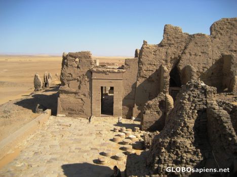
As you walk up the road look carefully at the lower slopes of the mountains on your left. These were stripped of loose stones to expose solid granite for quarrying. This quarry was the source of the first building blocks for the foundations of the monastery, the church and its fortification in the 6th century. The architecture of cut stone seems to have been gradually abandoned after the Arab conquest in the 7th century, although loose stones were taken from this quarry as late as the 19th century.
Look for the cut faces, chisel marks on flat rock surfaces and horizontal trenches used to wedge the blocks of granite away from the rock.
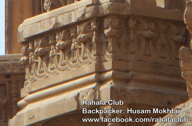
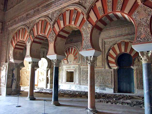
Site 5 Monastery of Saint Katherine (Catherine)
In 1822 Burkhardt recorded a monk telling him that if the Monastery of Saint Katherine "had been subject to the revolutions and oppressions of Egypt or Syria, it would have long ago been abandoned; but Providence has preserved us by giving us Bedouin for neighbors."
The Monastery and the Jebeliya Bedouin share a very close and interdependent relationship. In the past, the Jebeliya depended on the supplies and services that the monastery provided while the monastery was reliant on the local people for manual labor and protection. The Jebeliya are descendants of soldiers and servants who were sent by Emporer Justinain to build and maintain the monastery 1400 years ago. Intermarrying with local nomads and converting to Islam, the Jebeliya maintain beliefs about the sacred landscape which derive from both Christian and Muslim tradition.
Today the Jebeliya continue to be employed by the monastery as gardeners, stonemasons, groundsmen, bakers, blacksmiths, carpenters and general labourers. Traditionally, all disputes not settled by Jebeliya people have been presented to the Archbishop of the Monastery to resolve.
Since the 3rd century, Christian monks and hermits settled in small monastic communities around Mount Sinai to escape persecution and follow a life of prayer and devotion in the holy mountains.
In AD 330 Saint Helena, Emperor Constantine’s mother, erected a small church at the site of the Burning Bush, to commemorate the spot where God appeared to Moses, and a tower to serve as secure shelter for the monks. In the 6th century, the Byzantine Emperor Justinian ordered the building of a fortified monastery encompassing the church and tower.
Tradition relates that the relics of the martyr Saint Katherine were borne by angels to the summit of Mount Katherine where they were discovered and transferred to a reliquary in the basilica in the 9th century. From that time the place has become known as the Monastery of Saint Katherine.
Frequent attacks between the 15th and 17th centuries caused the gates of the monastery to be walled up by rope and pulley. Evidence of this system can be seen on the northeastern wall of the Monastery.
Notes
Jebeliya Bedouin and the Holy Mountain
A Jebeliya Bedouin man, Mahmuud Mansuur explains the significance of Mount Sinai to his people: "My family has been on the Mountain for 1400 years. It is a holy place to us. Not only do we depend on it for our livelihood, but our sick people climb the mountain to talk to God and ask for health or fertility. I’ve been climbing this mountain since I was fourteen- the mountain and I know each other well."
Site 6 Camel Path
The camel path begins from behind the Monastery near the camel station where Bedouin cameleers offer rides up Mount Sinai, stopping just short of Elijah’s Basin. The remaining 750 steps must be climbed on foot. The camel path was constructed by Ibrahim Abbas Pasha, ruler of Egypt from 1849-54. In 1853 he visited Sinai with plans to build a palace on Mount Sinai. The palace eventually was built on the summit of Jebel Abbas Pasha, a mountain west of Saint Katherine village, from where its ruins can be seen. The Stairway of Repentance begins about 200 metres to the right of the camel station and can be seen winding up the steep, rocky gorge. The remains of ancient walls can be seen in the mound to the right of the path; this archaeological site has not been excavated.
Continue up the path for about 900 metres to Site 7.
Site 7 Jebel El-Deir Path Junction Facing the engraved stone number the red granite massif rising to your left is Jebel El-Deir – the mountain of the Monastery. You can see several shrines, hermitages and gardens in the mountain crevices. A zigzag path leads to a small monastery, Magafa, which nestles amid date palms and Byzantine stone walls. It can be seen more clearly from Site 9.
Magafa
The small mountain to the south, i.e. on your right, is called Jethro’s Mountain or Jebel El-Muneijah (Calling of God). This site is where Jethro and his daughters were supposed to have lived when Moses first came to Mount Sinai and where he saw the Burning Bush and spoke to God. The small white church on its summit is dedicated to both Saint Theodore the Commander and Saint Theodore the Tyro, or Recruit, Roman soldiers who were martyred. Behind you, to the southwest, the furthest peak is your first view of Mount Sinai’s craggy double summit. Continue up the path for about 1km to Site 8. The Monastery disappears behind you as you ascend.
Site 8 Saddle Between Wadi El-Deir and Wadi Isbaiyah
To your left at the top of the pass you look south into the wide, sandy valley of Wadi Isbaiyah which formed part of the ancient trade route connecting the Monastery to both Palestine and Cairo. Camel caravans came over the pass below, marked by a pile of stones and colloquially called Nagb’I Deir, bringing food and supplies as well as pilgrims, scholars and other travelers, to the Monastery from the port of El-Tur on the Gulf of Suez. Below you can also see a small Bedouin village and gardens which are stone walled to keep out animals.
Follow the path for a further 600 metres to Site 9.
Site 9 Galaktion and Episteme
Site 9 is located on a bend in the camel path. Looking across to Jebel El-Deir, you can see a green tree midway up the mountain. To the left of this is the Monastery of Saint Episteme, a nun, and Saint Galaktion, a monk, who lived in the fourth century.
To your right you have a good view of the switch-back path leading to Saint Theodore’s chapel on the green tinged mountain of Jebel El-Muneijah.
Historical Notes
Lives of Galaktion and Episteme
Galaktion was the son of pagan parents who, in spite of sacrifices to idols, had been childless until they were advised by a priest to pray for a child to the God of the Christians. Galaktion was born and brought up as a Christian, he later married Episteme, also a Christian. They devoted their lives to God and became monastics. They settled in Sinai along with their followers to follow a life of devotion and to escape religious persecution but were captured by the Romans and martyred in the arena of Alexandria.
Continue on for about 1.2 kms passing 4 separate cafeterias to Site 10.
Site 10 Camel Station and Cutting
From the camel terminus, you climb through a narrow pass in the mountain which was cut through to continue to Abbas Pasha’s path to the summit. Evidence of the holes drilled for the explosives to blast open the way can be seen on the sides of the path. On some rock faces a black plant like pattern can be seen. After the pass the path leads left to the summit of Mount Sinai and right to Elijah’s Basin. Turn left and climb the final 750 steps to the summit – which takes about 25 minutes.
Nature Notes
Rays of God or Dendrites
On some rock faces a black leaf-like pattern can be seen. Some people believe that the patterns were caused by divine light so intense that it imprinted the shadows of living plants on stone and that it is reminiscent of the leaves from the Burning Bush.
this program brought to you by our Member :
Eman gouda
Preparation
**Wear sturdy shoes and a hat, take matches or a lighter, sunscreen, and a warm jacket for early mornings and evenings. Be aware of the season, as winter will require much warmer clothing and do not underestimate how cold it can become.
**If you stay overnight sleep only in Elijah’s Basin not on the summit.
**Respect the right of pilgrims to a quiet, peaceful experience on the summit.
**Respect the religious rights and the sanctity of the landscape and leave no trace of your visit.
**Do not collect or destroy plant or animal life or leave graffiti.
**Please dispose of your litter in the bins provided
**Please use the available environmental and hygienic toilets.
**Be very aware that the climb can be most difficult for the elder, and those with medical conditions that might be affected by climbing, such as heart problems, emphysema and related illnesses


